(This site was last updated on 2nd January 2023
The objective of this article is to record as much of the
I’ve been photographing the towns and villages of
Photographs that are in thumbnail form only will be gradually updated to High Resolution.
One of the host
sites for some of these articles is not working any longer. These will be
re-instated as soon as possible. See below.
Extras : Places and events from my
collection that are not necessarily directly connected with
(New) On the Buses A look at buses and staff of days gone
by.
(New) North York Moors Railway
Recent
additions: NEW Stolford Blagdon Burrowbridge
Tip; To retain this page, use the middle mouse button.
To see a collection of some of the towns and villages on this site (one picture of each) click here
(Re-instated but still building on)
Index
A B
C D
E F
G H
I J
K L
M N
O P
Q R
S T
U
V W
Y
Look back as villages will be added or
updated
***On This Day in
Britain***
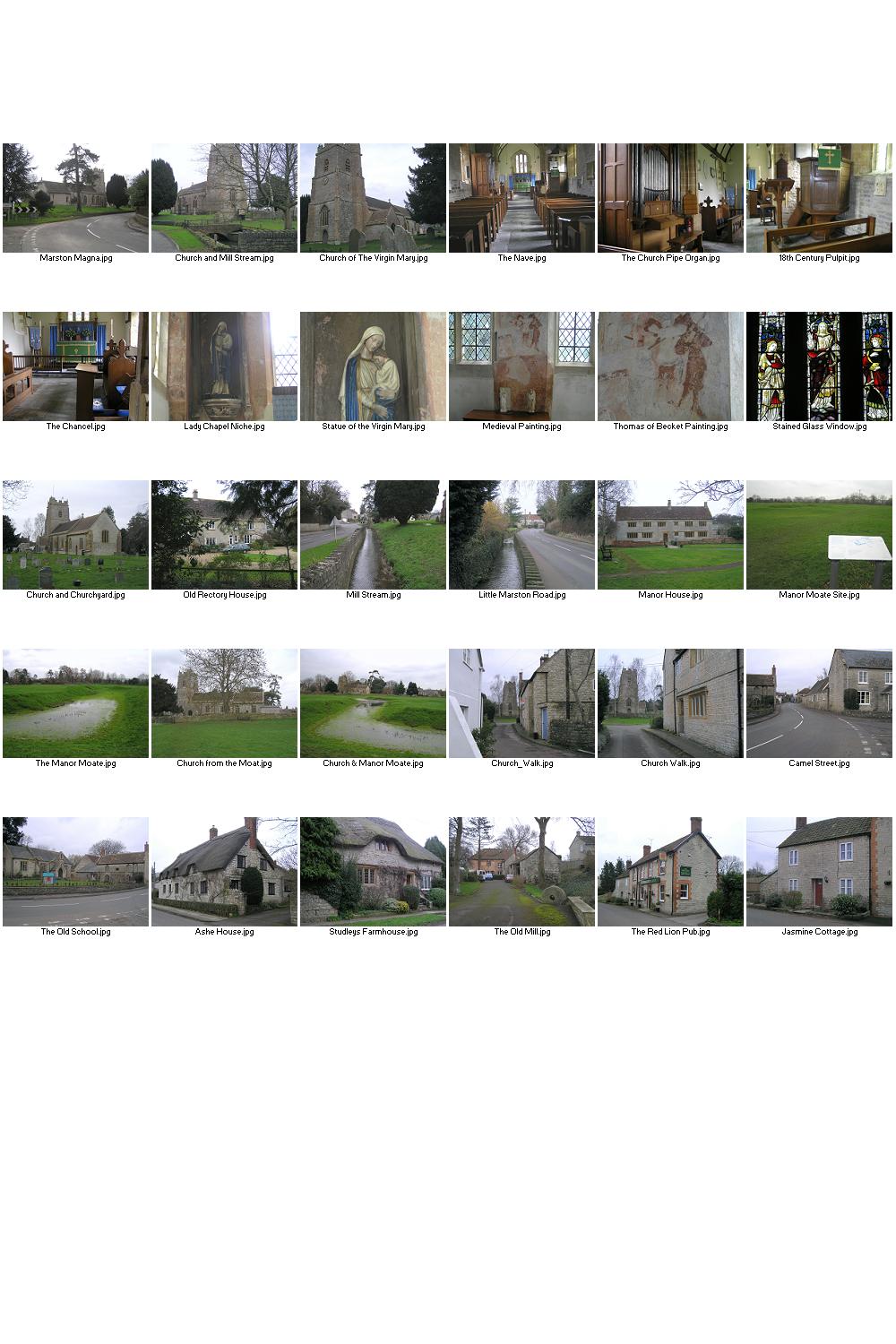
Alford is a very small settlement about 10 miles southeast
of
Alhampton Tin Tabernacle built in 1892.
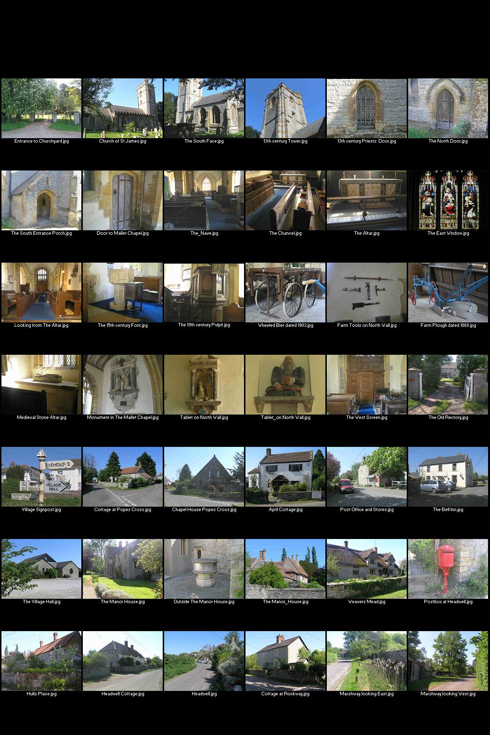
Aller lies 10 miles southeast of the Town of
Allerford is
located within the Exmoor National Park. One of the village's main attractions
is the much-photographed
Angersleigh is about four miles to the south west of
The small
Ashcott lies on the Polden Hills about five miles from
Ashill is a small village situated 7 miles southeast of the County Town of Taunton. It has a small primary school, a village pub, a village hall and a playing field.
Ashington is a very small village about three miles north of
the large market town of
The area is
known as the Isle of Athelney, because it was once a very low isolated island
in the 'very great swampy and impassable marshes' of the Somerset Levels.
The medieval town of
Babcary is very small village situated five miles east of Somerton in the South Somerset District.
Badgworth is a village in the Sedgemoor district of Somerset
lying 20 miles southwest of
The village of Baltonsborough lies about four miles southeast of Glastonbury with views towards Glastonbury Tor and the Mendip Hills.
Banwell is a village in
Barton St. David is a quite, peaceful village in the central
part of
Beercrocombe is a village near the County Town of Taunton
between the
Berrow has a medieval church dedicated to St Mary Magdalene and it dates from the year 1150. The magnificent stretch of sandy beaches run from the seaside resort of Burnham-on-Sea right up to the foot of Brean Down.
Bicknoller is a picturesque village on the Quantock Hills. The 12th century church is dedicated to St. George.
Located in the Vale of Taunton Deane, Bishops Lydeard is a small village near the market town of Taunton. It lies at the foot of the Quantock Hills in an area of outstanding natural beauty.
Blackford (nr Wedmore)
Blackford is a small village about 23 miles south of the
city of
The village is located on the northern edge of the Mendip
Hills overlooking
Bleadon lies about four miles south of the popular seaside
resort of Weston super Mare. The 14th century
The
The town of
The earliest record of the
Brompton Regis was formerly known as Kingsbrompton. It lies
within the
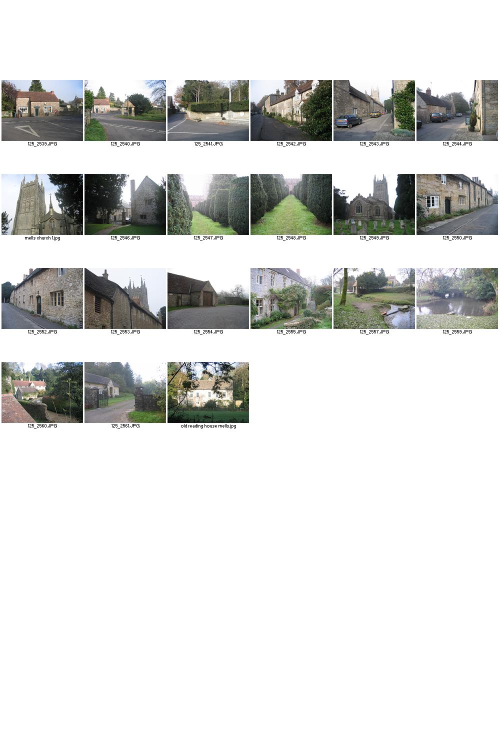
Bruton is a picturesque Town on the River Brue founded in about the 5th century. Located in the Vale of Blackmore, it’s surrounded by tranquil countryside.
Collectively, Burnham on Sea, Berrow and Brean have one of the longest stretches of golden sand in Europe stretching to a total of seven miles.
There is a legend that Augustus Montague Toplady was inspired to write the hymn ‘Rock of Ages’ while sheltering in a cleft in the rock at nearby Burrington Combe during a thunderstorm in the late 18th century. The rock was subsequently named after the hymn.
Burrowbridge is a village situated either side of the River
Parrett and on the edge of the Somerset Levels. The road bridge over the River
Parrett was built in 1826 and was the last toll bridge in
Bury is a very small village on the southern tip of the Exmoor National Park and about 25 miles west of the County Town of Taunton.
The
The village lies about three miles west of the town of
Carhampton is a village in North West Somerset 4 miles to the east of the seaside resort of Minehead.
Carhampton is famous for its wassailing celebration which was started in the 1930's by the Taunton Cider Company. Wassailing in Carhampton takes place each year on January 17th in the orchard of the Butchers Arms Pub. This is preceded by a smaller event in the Community Orchard in the centre of the village next to the pub. The villagers form a circle around the largest apple tree and hang pieces of toast soaked in cider in the branches for the robins, which represent the good spirits of the tree. A shotgun is fired overhead to scare away evil spirits.
Castle Cary lies about 30 miles east of the County Town of
Taunton and about 26 miles south of the City of
Chaffcombe is a quiet little village in the south of the
County, about two and a half miles from the town of
Chard is a market town laid out in 1234 by Bishop Jocelyn of Wells. It grew into a prosperous wool town. In the 19th century cloth making was replaced by lace making and producing agricultural machinery.
Charlton Adam is a small, quiet village in the east of the county. It's situated about three miles east of the market town of Somerton in the district of South Somerset.
Charlton Mackrell has a long history and was mentioned in The Domesday Book. It's a small village on the eastern side of the county.
Charlynch is a suburb of the village of Spaxton 4 mile west of Bridgwater and 10 miles north of the County Town of Taunton.
Set in the Mendip Hills, Cheddar is famous for its Gorge,
the largest in
Chewton Mendip
is on the Mendip Hills and is situated 4 miles north of Wells, 16 miles south
of the City of
The
Although a very small village in its own right, it is more
of a suburb, north of the town of
Situated on the edge of the
The village consists mainly of small cottages built of the
local golden Ham Hill stone. It’s situated about five miles west of the
town of
The small village of Christon lies about 20 miles southwest of the City of Bristol.
Churchinford lies nine miles south of the County Town of Taunton. The village was known in the 13th century as Cheristone meaning stony settlement where cherries grow.
The village is situated within the Blackdown Hills Area of
Outstanding Natural Beauty 5 miles south of the County Town of Taunton.
The town of
A small village in the south of the County with at least one unfriendly person.
The village is situated about
seven miles
The villages lie about 11 miles south east of the County
Town of Taunton in the
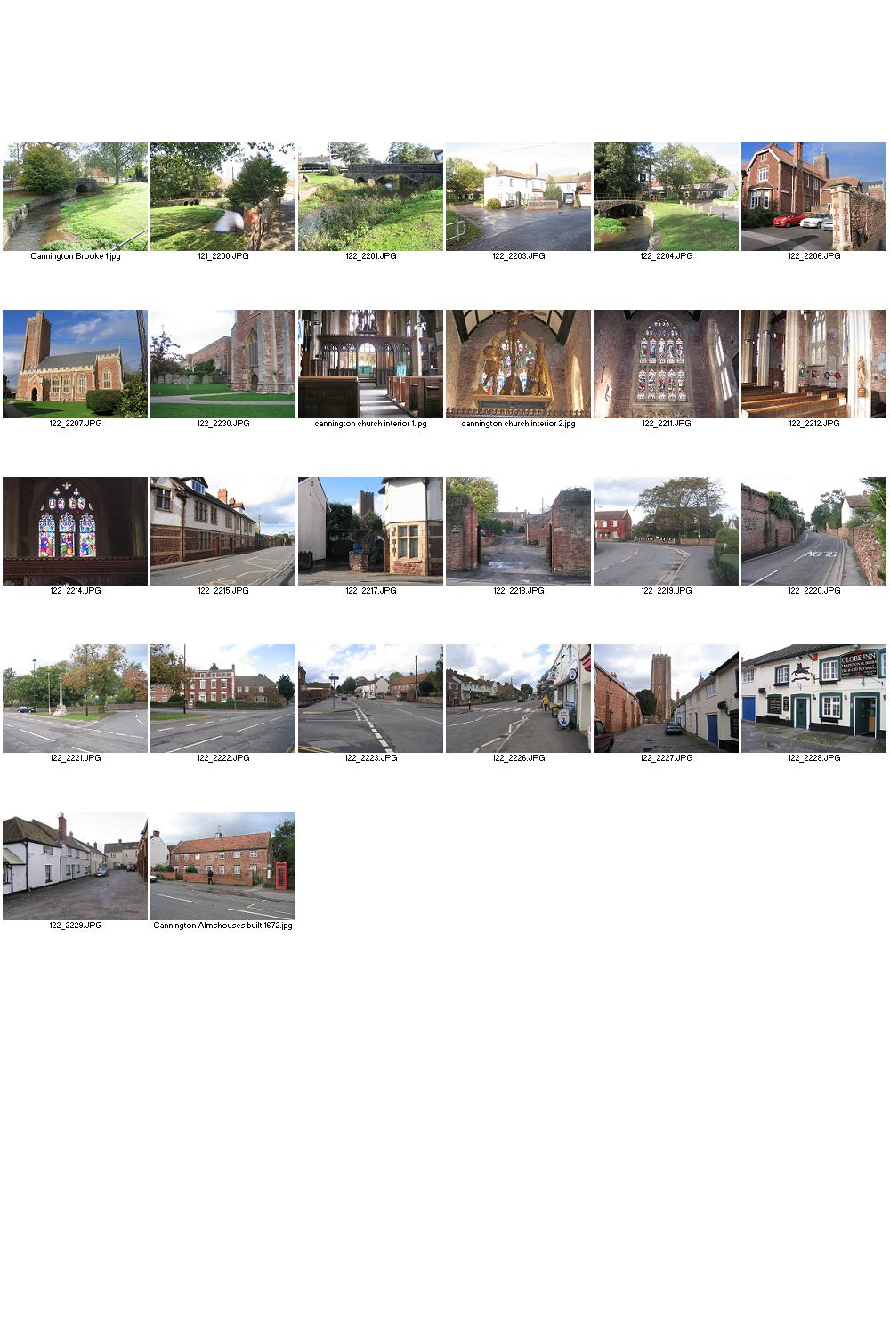
Combwich (pronounced "Cummidge") is about 5 miles from Bridgwater on the road to Hinkley Point Nuclear Power Station. It lies beside the River Parrett and served as a port for the export of local produce and the import of timber from the 15th century. It also served the local brick yard from 1842 until the creek silted up in the 1930s.
The village is in the north of the County, about six and a
half miles west of
Corfe village is four miles from the County town of
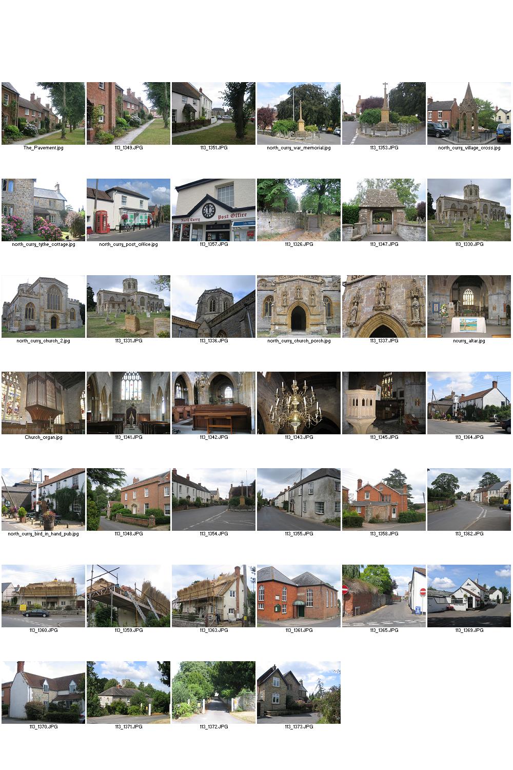
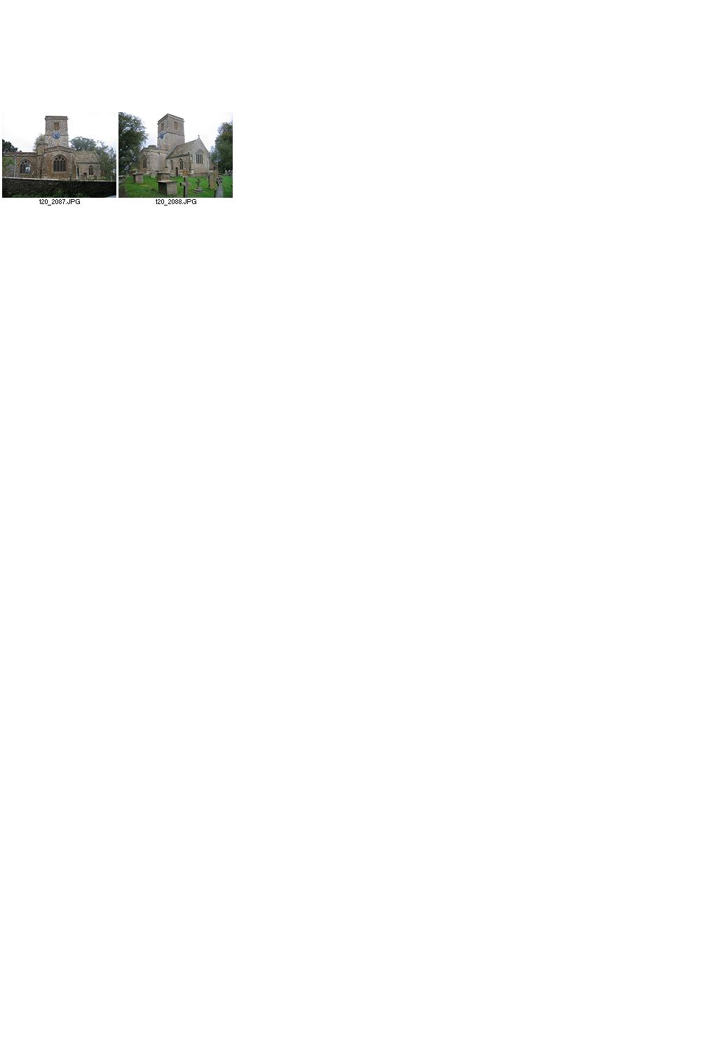
The village is situated three miles east of the County town of Taunton. The name is derived from creek, on the River Tone, which creates an island in the river to the south of the village and the 12th century Church which is dedicated to St. Michael. The Bridgwater & Taunton Canal carries pleasure boats through the village and the tow path is open to pedestrians and cyclists.
The Georgian market town of Crewkerne lies in
The
Crowcombe lies at the foot of the Quantock Hills, just off
the A358 road that runs between
The village is situated about eight miles east of the County Town of Taunton.
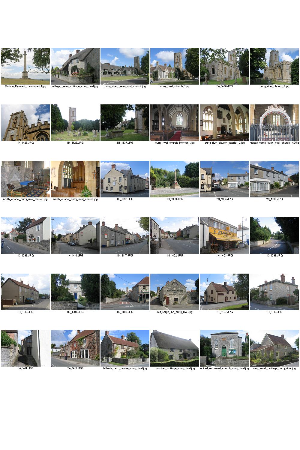
Curry Rivel is situated ten miles east of the County Town of Taunton. The name of the village comes from the Celtic word ‘crwy’ meaning boundary and Rivel from its 12th Century landlord Sir Richard Revel.
Dinnington is in the south of the County and only about 17
miles from the
The village is in the Mendip District of the County and lies
26 miles due south of the City of
Dodington is a small village in the parish of Holford on the northern slopes of the Quantock Hills.
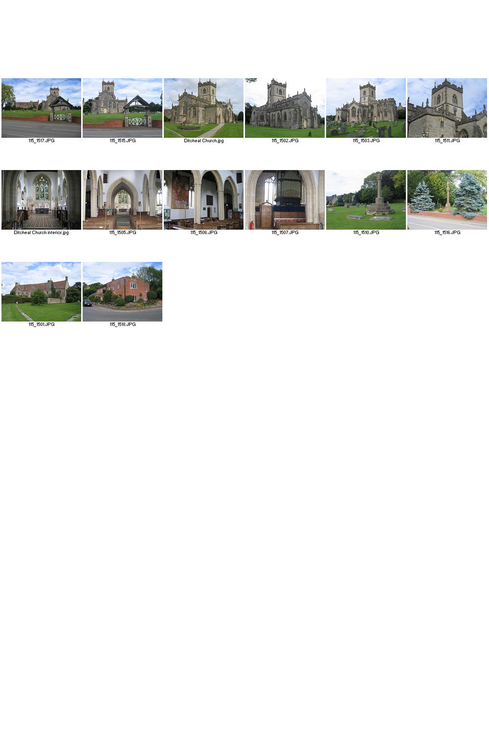
The village of Doulting lies 22 miles south of the City of Bristol and 34 miles East of the County Town of Taunton. The village dates from the 8th century when King Ine of Wessex gave the local estate to Glastonbury Abbey after his nephew St Aldhelm died in the village in 709. Today it is a thriving community revolving around the Church with numerous pleasant walking routes around the village and the surrounding countryside.
The village is situated 2 miles south of Ilminster and 5 miles north east of Chard in the district of South Somerset. Cider is produced at Perry's Cider Mill, manufacturers of several award winning Ciders. The barn is used as the Cider Mill, and now contains a museum. A cafe opened at the mill in 2008.
Drayton is a village situated about a mile from Curry Rivel and five miles southwest of Somerton in the district of South Somerset.
Dulverton is situated on the south edge of
Situated in the hills of
Durleigh is a village on the outskirts of Bridgwater in the Sedgemoor District of Somerset. The village lies on Durleigh Brook, which was dammed in 1938 to form Durleigh Reservoir.
The village of Durston lies about 5 miles northeast of the County Town of Taunton and is on the main A361 road between Taunton and Glastonbury.
East Huntspill village lies about 20 miles north of the
County Town of Taunton and 30 miles south of the City of
East Lambrook is a delightful little village in
East Lyng is a small village 8 miles east of the County Town
of Taunton and 14 miles west of the Town of
East Pennard is a very small village about five and a half
miles from the town of
Enmore is a village 2 miles west of Bridgwater on the Quantock Hills in the Sedgemoor district of Somerset.
The village is situated approximately nine miles north west
of the County Town of Taunton. Fitzhead is a small, rural village set in
beautiful countryside and surrounded by Areas of Outstanding Natural Beauty; the
Quantock Hills and the Blackdown Hills and it is close to
Fivehead is a
village situated on the Fivehead River, 8 miles east of the County Town of
Taunton.
Four Forks is a hamlet of the
The Abbey Ruins are in 36 acres of beautiful grounds which include a fish pond, duck pond, herb garden, cider orchard, and picnic and wildlife area. It is also possibly the burial place of King Arthur.
A small village about three miles from Bridgwater at the
foot of the Quantock Hills. On the outskirts of the village is the
Halse is a village situated 6 miles
A very small village near the River Tone about five miles southwest of the County Town of Taunton.
Ham Hill is the site of a very large Bronze Age and Iron Age Hill Fort. There are fine views to the Mendip Hills, the Blackdown Hills and the Quantock Hills. It’s located about 20 miles to the east of the County Town of Taunton.
The village is situated six miles south-west of Yeovil in
the
Hatch Beauchamp is situated five miles south-east of the
County Town of Taunton. The village has an
The small village lies 5 miles North West of the County Town of Taunton
Acknowledged as one of the ten most important historic gardens in Britain, Hestercombe is a unique combination of three distinctive gardens, designed over three centuries. There are breathtaking views across the Vale of Taunton to the Blackdown Hills.
The village is recorded in the Domesday Book (1086) as Hame meaning ‘home’ from the Old English ham. It is situated on an elevated peninsular 280 feet above sea level, with panoramic views across the Levels. In times past it was an island rising from the surrounding marshes. There is a fine village green surrounded by trees and a fine group of listed buildings. The village lies 15 miles east of the County Town of Taunton.
Highbridge is situated on the edge of the Somerset Levels near the mouth of the River Brue. It grew to importance with the railways, but has suffered with their decline.
Hillfarrance is a small hamlet 3 miles from the M5 junction
at
Hinton St George is situated 3 miles from of Crewkerne, ten miles south west of Yeovil in the south of the County.
Holford is a village in West Somerset within the Quantock Hills Area of Outstanding Natural Beauty, and about 10 miles west of Bridgwater.
Hornblotton is a small village just off the A37 about 8 miles Southeast of Glastonbury. A most unusual feature is the interior of the Church. It is decorated using a technique known as sgraffito. Here two layers of different colour plaster are laid on the walls and then one layer is carved to reveal the other colour below. It is probably the only church interior in the country to be wholly decorated by this technique.
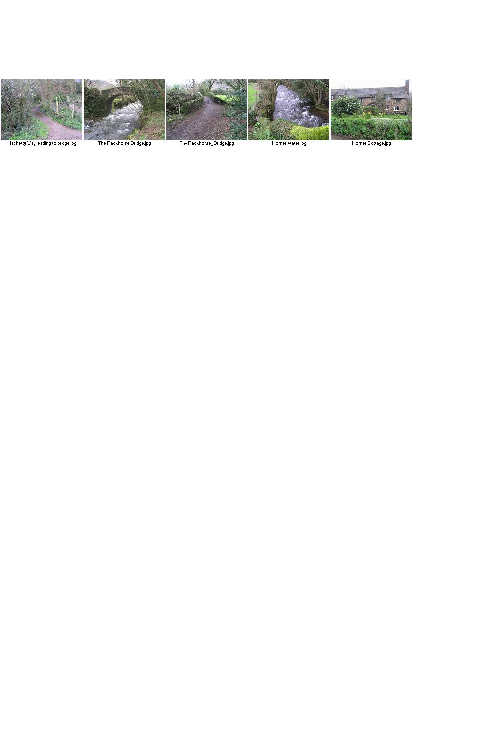
Horner lies in the
The village is in the south of the County about two and a
half miles from the town of
The village lies about 15 miles east of the County Town of Taunton.
The
Ilchester lies 4 miles southeast of Somerton, 5 miles north
of Yeovil, and 122 miles southwest of
Ilminster lies in the beautiful countryside of South Somerset about 15 miles west of Yeovil and 12 miles southeast of the County Town of Taunton, close to the A303 and within easy reach of the M5. Fishing, walking and cycling routes can be easily accessed from the town without having to use a car and Ilminster has a range of good quality accommodation of Hotels and Guest Houses.
Ilton is a small village situated 8 miles southeast of the
County Town of Taunton and 50 miles south of
Isle Abbots
(sometimes spelled Isle Abbotts) is a village situated
Keinton Mandeville lies about 23 miles east of the County Town of Taunton. At the time of the Domesday Book it was known as Chintone meaning the Noble's enclosure. The Mandeville part of the village's name came from Stephen de Mandeville in about 1243.
Kewstoke is three miles from Weston-super-Mare and twenty
miles southwest of the City of
Kilve is situated on the main A39 road about halfway between the Towns of Bridgwater and Minehead and lies within the Quantock Area of Outstanding Natural Beauty, the first A.O.N.B. (area of outstanding natural beauty) to be established in 1957. The village is served by a Post Office, public house and general store with the beach approximately one mile away. For those who enjoy the countryside, there are footpaths enabling superb walks on the Quantock Hills.
Kingsdon is situated 21 miles east of the County Town of
Taunton near the Fosse Way Roman road. The village name is derived from
Kingsdon Hill which is in the
Kingston Seymour is a small village near the Bristol Channel
about 15 miles southwest of the City of
The village lies just 3 miles outside the County Town of Taunton. The parish once belonged to the Kings of the West Saxons hence its name "The King's settlement". It is only since the 1950s that it became officially known as Kingston St Mary, the Saint being the dedication of its Parish Church.
A small village about 20 miles east of the County Town of Taunton.
Langport lies on the east bank of the River Parrett and is 15 miles east of the County Town of Taunton. During the winter the low lying areas around Langport are sometimes flooded.
Litton is a
very small village between Chewton Mendip and
The village is situated on the River Yeo five miles south of Somerton and about fives mile north of Martock in the district of South Somerset. A bridge over the river is known to have existed by 1335, while by 1448 there were wharves for the loading and unloading of cargoes from boats using the river. The river was the subject of the abortive ‘Ivelchester and Langport Navigation’ in 1795, and although the works were never completed, traffic on the river was sufficient for the coal merchants Stuckey and Bagehot to establish a coal yard near the bridge by 1824. Cargoes arriving at the wharves included slates, bricks, tiles and coal, while the main export was timber.
At the time of the Domesday Book Low Ham was part of the estate of Serlo de Burcy, and was later known as Ham Burcy and Nether Ham. The village lies 16 miles east of the County Town of Taunton.
Luccombe is a quiet backwater village with traditional
thatched cottages lying in the
The name Martock comes from the Old English words
"mart" meaning market and "ac" for Oak and relates to an
Oak tree on the spot now occupied by the Market House. The Town lies 22 miles
to the East of the County Town of Taunton and 40 miles South of the City of
Middlezoy, meaning the middle stream island, is situated on the Somerset Levels, 13 miles north east from the County Town of Taunton. At one time the village had three shops but all were eventually closed including the village Post Office. After a lot of hard work by the villagers, the Post Office and shop were reopened in the grounds of the Chapel opposite the village school.
The seaside town of
Monksilver is a village is on the eastern side of the
Montacute lies 4 miles west of the town of
The village is best known as the site of Muchelney Abbey, a Benedictine Abbey founded by King Athelstan in 939, and largely demolished in the Dissolution of the Monasteries by Henry V111.
Mudford is a village situated three miles from the large
town of
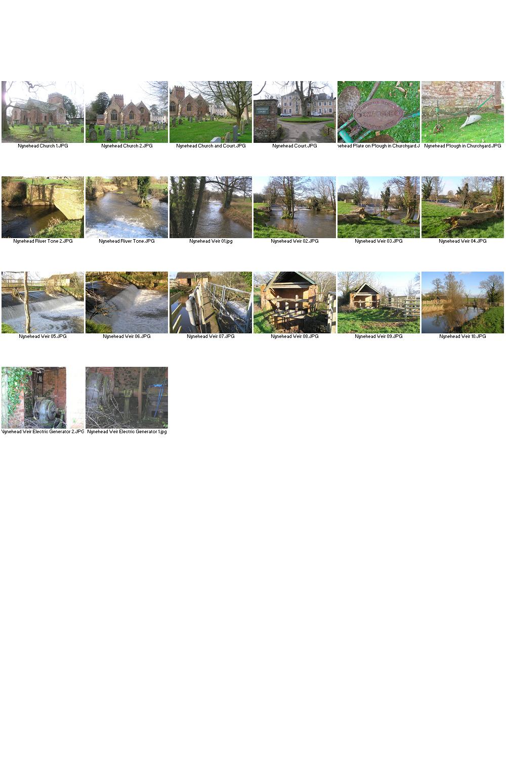
The village is just over seven miles north east of the County Town of Taunton. The Newt Beer Festival is held every year in the village and is host to some of the finest beers to be found in the Country.
Norton-sub-Hamdon is a village in the South Somerset district of Somerset, situated five miles west of Yeovil.
Odcombe is a village in south Somerset 3 miles west of the town of Yeovil and 23 east of the County Town of Taunton. The village is built predominantly out of the local hamstone still quarried on Ham Hill, two miles to the west.
The village of Othery, established in 1515, sits on a detached extension of Sowy Island on the Somerset Levels.
The
A very small village about 20 miles southeast of the County Town of Taunton, 21 miles North of the Dorset Coastal Resort of Lyme Regis and 60 miles South of the City of Bristol.
The village is well served with amenities. There are two shops, one of them also being a Post Office, two social clubs, a superb village hall, a school, two parks and children’s play areas, a sports field, a church, a chapel, a garage, a cafe and a thirty minute bus service to either Bridgwater and Taunton in one direction or Highbridge and Burnham on Sea in the other.
Penselwood is a small village on the east of the County near
the
Pensford lies in the Chew Valley 7 miles south of
Lying just over six miles to the east of the town of
Pitney is a
village and parish located 2.5 miles east of Langport and 3 miles west of
Somerton in the South Somerset district.
Podimore is a very small village in the south of the County
lying about 8 miles north of the town of
Porlock is a charming village with narrow streets and many interesting shops. Its origins can be traced back to the 12th century and has some lovely old thatched buildings, an ancient parish church and a museum.
Puriton is a village and parish at the Westerly end of the Polden Hills, in the Sedgemoor district of Somerset. The village has a full range of facilities, such as a primary school, parish church, pub, shop (general store and newsagent), butcher and hairdresser.
The small
Queen Camel
is a village on the River Cam in the
Raddington, along with the hamlet of Waterrow, is one of the three hamlets that make up the parish of Chipstable. It is a very scattered community of a few farms but even they are a long way from the Church. It must be one of the most peaceful places on earth.
The village lies about 13 miles southwest of the city of
The
The
Seavington St Michael is situated next to the village of Seavington St Mary, about 3 miles east of Ilminster, within the South Somerset district. Seavington St Michael appears to have become the more important since the motor car forced the building of New Road to straighten the London to Exeter route early in the 20th century, thus by-passing Seavington St Mary. Since then, in 1988 the new Ilminster by-pass has eliminated much traffic, although the road through Seavington St Michael is still a major access route to the market town of Ilminster.
Selworthy is a small village 3 miles from Minehead located
on the Northern fringes of
Shapwick is a village on the Polden Hills overlooking the Somerset Moors. It is situated about 7 miles to the west of Glastonbury.
Shipham is a Village on the Western edge of the Mendip Hills
approximately 15 miles south of
The name of Spaxton originates from "Spakr", a
Dane who settled in the area in about the 9th century. It was recorded as Spacheston in the Domesday Book
of 1086. The village lies about 6 miles west of the town of
The village is within the Blackdown Hills Area of
Outstanding Natural Beauty.
The
The Steart
Marshes are a wetland area fed by the River Parrett as it makes its way to
Bridgwater Bay, on the north-west coast of Somerset. The wetland area is
managed by the Wildfowl and Wetlands Trust as a nature reserve and as an important
wildfowl habitat, with a large bird population, especially in winter, as well
as wildlife such as brown hares, otters, and roe deer.
The ancient
parish of Stockland Bristol, formerly Stockland Gaunts, derived its secondary
names from its former owners, first the Gaunts hospital, Bristol, and later
Bristol Corporation.
Stocklinch is 13 miles South East
of the County Town of Taunton. The village is one of Somerset's nine Thankful Villages
(from a total of 52 villages in England and Wales) in which all the men who
served in World War 1 came home, and one of only 14 doubly-thankful villages in
the country as it also did not lose any soldiers in World War 2.
Stogumber is set in a valley between the Quantock and
The village is situated near the
Stoke St. Mary is a little over 2 miles from the County Town of Taunton. The earliest recorded mention of the village is in a Saxon charter dated 854 AD, when a West Saxon King gave the clearly defined lands at ‘Stoc’ to the Church at Taunton.
Stolford is a hamlet of 10 or so houses tucked in behind the sea wall on Bridgwater bay.
The village is 10 miles west of Bridgwater, and close to the villages of Holford, Kilve and Stogursey.
The small parish of Swell lies 10 miles east of the County Town of Taunton.
The ancient 3000 year old
Thorney is a very small village
within the parish of Kingsbury Episcopi. It lies about 45 miles south of the
City of
Thurloxton is 5 miles north east of the County Town of Taunton and 5 miles south west of Bridgwater on the south-eastern slopes of the Quantock Hills. The village probably takes its name from Reyner Thurlac, the 12th-century lord.
The village lies within the
Treborough is a very small village
7 miles south of Dunster, lying amongst the
Trudoxhill is
a small parish situated just off the A361 between Frome and Shepton Mallet.
The village lies about two miles south of the County Town of Taunton. The name Trull is thought to derive from the word ‘Trendle’ meaning circle or wheel.
Uphill is situated at the south end of
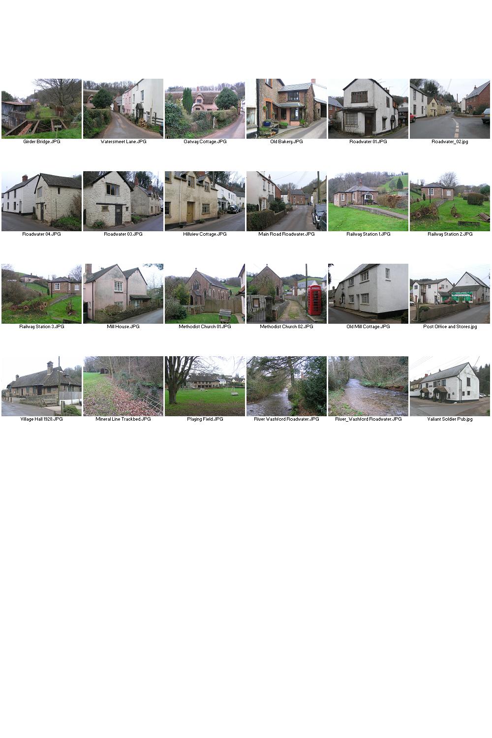
Washford is a
small village in the district of West Somerset, along the A39 between Minehead
and Williton. It is less than two miles from the Bristol Channel Coastline. The
West Somerset railway, a preserved steam railway, has a station at Washford.
The old signal house at Washford has been converted into a museum for the
Somerset and Dorset Railway Trust. The site was derelict until the Trust took
over in 1976, since then they have transformed the area into a superb museum.
A charming little seaside town on the north coast of Somerset with an active marina, excellent holiday accommodation, quaint cottages and shops. An ideal place to stay for a few days or even longer, with many walks in the beautiful countryside, along the lovely coastline or just sit on the Esplanade and relax by the harbour.
Waterrow is half way between Wiveliscombe and Bampton on the
B3227 and is on the southern fringe of the
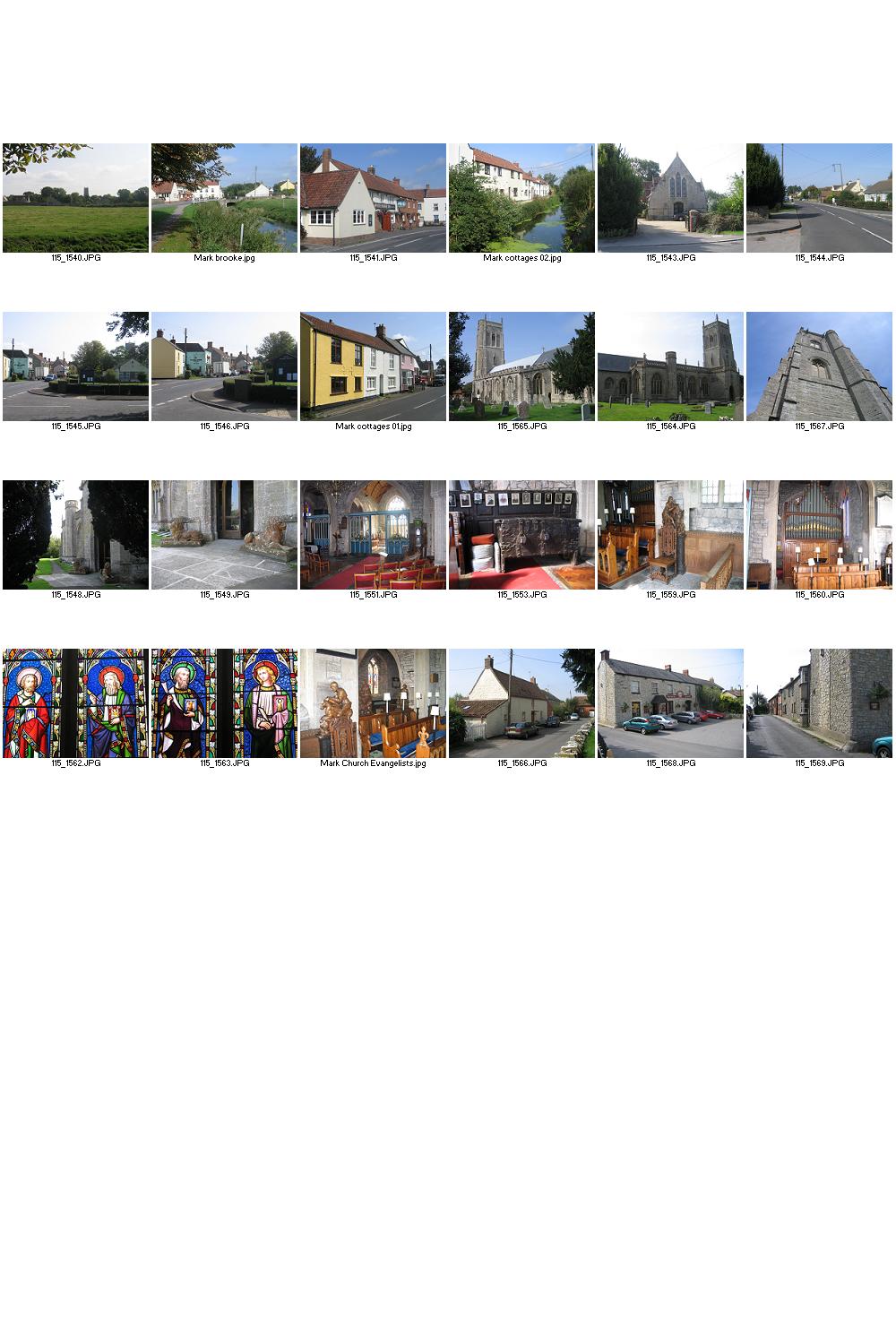
The Saxons named it "The Isle of Wedmore" Now its facilities include a medical and dental practice, pharmacy, butchers, a village store with off licence, three pubs, restaurant, café and several other local shops. It is located 4 miles south of Cheddar, 7 miles west of the city of Wells and 7 miles North West of Glastonbury.
Wembdon is a
rural village on the outskirts of Bridgwater.
Wells is named from three wells dedicated to Saint Andrew, one in the market place and two within the grounds of the Bishop's Palace and cathedral. The City lies at the foot of the southern part of the Mendip Hills where they meet the Somerset Levels. It has all the modern conveniences plus shops, hotels and restaurants. Wells is a popular tourist destination, due to its historical sites and its proximity to Bath, Stonehenge and Glastonbury.
The village of West Bagborough lies on the slopes of the Quantock Hills about five miles from the county town of Taunton. When the Doomsday book was compiled in 1086 the village was mentioned as Bageberge.
The very small village lies about five miles east of
The village
of West Buckland lies 5 miles southwest of the County Town of Taunton.
West Camel is
a village about 7 miles north of the town of
The village lies 3 miles west of
Yeovil and about 26 miles south east of the County Town of Taunton. The name Coker comes from Coker
Water (crooked stream from the Celtic Kukro).
The village had a long history of growing hemp and flax for sailcloth
manufacturing, known as "Coker Canvas" which was highly prized by
naval captains during the Napoleonic Wars.
West Hatch is a hamlet situated 5 miles south east of the County Town of Taunton.
The village
lies mainly west of the Fosse Way between Shepton Mallet and Ilchester. It is
crossed from east to west by the River Brue.
Westonzoyland is in the District of Sedgemoor and lies about 14 miles north east of the County Town of Taunton and is the site of the last battle fought on English soil in 1685.
West Pennard village lies on the main A361 road 3 miles east
of the town of
Wheathill is not a village as such but a couple of farms and
a church that is now privately owned. It lies about 9 miles southeast of
Whitelackington
is a village on the A303 one mile north east of Ilminster. The village was the
main home in the 17th century of the Speke family.
The parish of Whitestaunton, known as
The village lies on a small creek known as Slutspill near the River Yeo which was inundated in the
Williton is situated in the north of the County about equal
distances from the towns of Bridgwater, Minehead and the County town of
Situated on the western edge of the Mendip Hills, the
The village is within the
Withycombe is
a village 2.5 miles south east of Dunster and 5 miles from Minehead within the
Withypool is
a small village near the centre of the
Wiveliscombe is a small town situated 9 miles west of the County Town of Taunton. It is situated just 5 miles from the border between Devon and Somerset at the foot of the Brendon Hills and is a gateway to the Exmoor National Park.
The village lies about two miles to the west of the City of
This is the
Wootton Courtenay lies entirely within the
The village lies about seven miles
east of the County Town of Taunton. Work on the
Wrington lies
in the valley of the River Yeo (often referred to as the Congresbury Yeo, after the village of
Congresbury through which it flows, to avoid confusion with other similarly
named rivers) about 9 miles east of Weston super Mare and about 12 miles
southwest of the City of Bristol. The village dates back to Roman times and
there is strong evidence of Saxon occupation.
Yatton is a very large village in North Somerset located 11
miles south west of the city of
Extras: Places and events from my collection that are not
directly connected with Somerset Towns and Villages.
On the Buses
(new)
Buses and staff of days gone by, mainly in the Bridgwater area plus a
few others.
St Ives is
situated on the shore of St Ives Bay on the north coast of Cornwall. Once it
was commercially dependent on fishing but the decline in the industry caused a
shift in commercial emphasis and the town is now primarily a popular holiday
resort.
Bridgwater Firefighters in the 50s
B&W pictures of Firefighters of Bridgwater,
Paignton and
Goodrington, Devon, England
Starcross is a village situated on the west shore of the Exe Estuary. Brunel's Atmospheric Railway is commemorated in the Atmospheric Railway pub located opposite the present day railway station. Note that the Brunel pumphouse now houses the Starcross Fishing and Cruising Club rather than the museum that was dedicated to the Atmospheric Railway, as quoted in many guide books. Dawlish is a small town and seaside resort on the southeast coast of Devon. Tourism is still its main industry attracting many thousands of visitors during the spring and summer months.
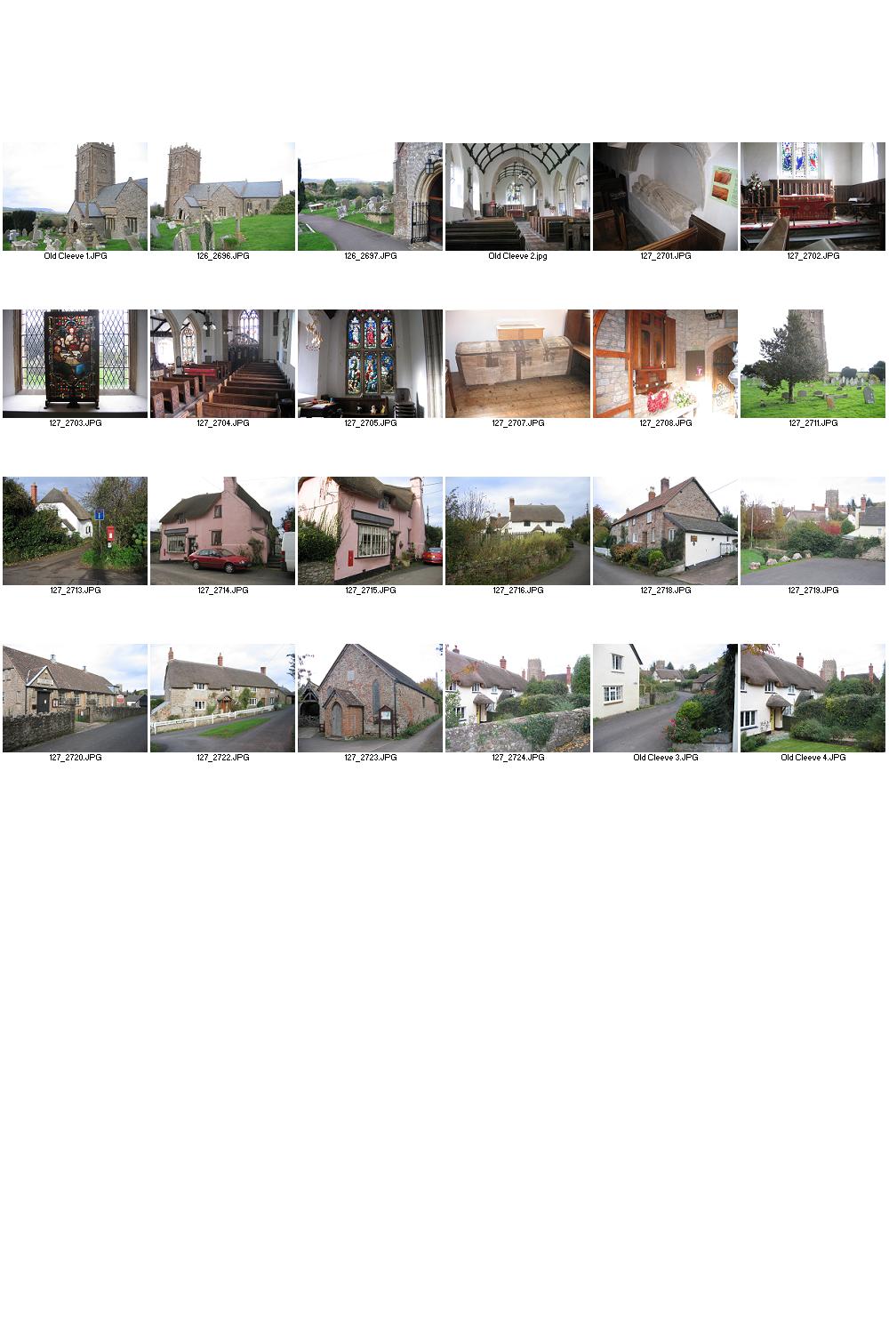
This lovely village dates back over a thousand years.
Situated on the north coast of
The funeral took place on the 6th August 2009 at Wells Cathedral in Somerset of Harry Patch who was the last of the soldiers of the First World War who fought in the trenches.
British
Icons.....RED Telephone Boxes
The red telephone box was once a familiar site in the
This traditional maritime town, with its old cobbled streets, picturesque houses and sandy beach is a great place for a holiday or short break.
Western National Bus Company Reunion held at the Rugby Club,
North Petherton,
Westonzoyland
Secondary Modern School (invitation to add photos connected with the school)
A collection of old black and white pictures taken in the 1950s.
Tribute to William Keirl, Middlezoy, Somerset
William Keirle died on the 8th September 2007. He loved Harvest Festival and this was the theme held at the Holy Cross Church in his memory on the weekend of the 27th and 28th September 2008 with the beautiful displays made by many volunteers from the village.
The Brecon Mountain Railway, South Wales
The railway located just off the Heads of the Valleys trunk
road - about 3 miles north of Merthyr Tydfil in
Closed by British Rail on the 6th March 1965, in June 1967 a small group of local people formed the North Yorkshire Moors Railway Preservation Society. Its members were convinced that operating the line between Grosmont and Pickering could be viable if sufficient voluntary help was forthcoming. On the 1st May 1973 HRH Duchess of Kent officially opened the NYMR.